# Apply custom geopolitical views
{`
HERE Maps API for JavaScript version 3.2
`}
By using the [HERE Vector Tile API](/map-rendering/docs/introduction-vector-tile-api) in conjunction with the HERE Maps API for JavaScript, you can present borders that are subject to varying viewpoints, allowing you to meet diverse user preferences and geopolitical considerations. Whether you want to emphasize borders based on international agreements or showcase them from the standpoint of a specific country, the HERE Vector Tile API enables you to create maps that faithfully represent disputed boundaries.
In the HERE Vector Tile API data model, disputed borders are encoded within the `boundaries` layer, through the `kind:xx` property, where `xx` represents the supported country code, reflecting the political standpoint of a particular country. For more information about the `boundaries` layer and the list of all supported geopolitical views, see the following documents:
* [Boundaries layer](/map-rendering/docs/layers-boundaries)
* [Geopolitical views](/map-rendering/docs/geopolitical-views)
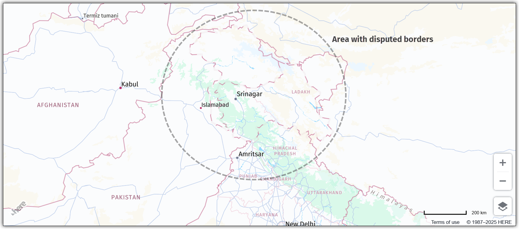
By default, the HERE Maps API for JavaScript presents an international perspective by displaying disputed borders as dashed lines. The following figure illustrates this view in the context of Jammu and Kashmir, along with Ladakh, a region situated between Pakistan and India:
## Switch geopolitical views
Note
The example in this section builds upon the base map described in [Get started with HERE Maps API for JavaScript](https://docs.here.com/maps-api-for-js/docs/quick-start) as the foundation for introducing code additions.
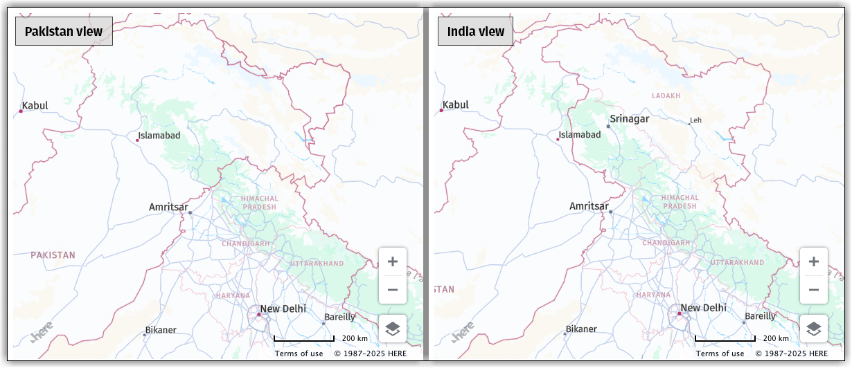
To switch the map display from the international perspective to a geopolitical view of a particular country, use the [`setPoliticalView()`](/maps-api-for-js/page/maps-api-for-javascript-api-reference-3-2-h-service-omv-provider) method of the [`H.service.omv.Provider`](/maps-api-for-js/page/maps-api-for-javascript-api-reference-3-2-h-service-omv-provider) class, as shown in the following example:
```javascript
map.getBaseLayer().getProvider().setPoliticalView("in");
// change to "pk" for the Pakistani view on Kashmir
```
This code from the preceding example sets the geopolitical view of the map to the Indian one (`in`).
**Result**: The following figure shows how HERE Maps API for JavaScript renders disputed borders, depending on the selected geopolitical view: