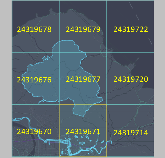
Feature tile assignment
In many instances, map feature geometries can span across multiple tiles based on the feature. For example, these map feature geometries may be long linear features, such as rivers or railroads, or large polygons, such as natural parks or municipality boundaries.
When a feature spans across multiple tiles, the data defining the feature lives in only one of the tiles its geometry traverses. The tile where the feature lives also contains the southern and western most shape point of the feature.
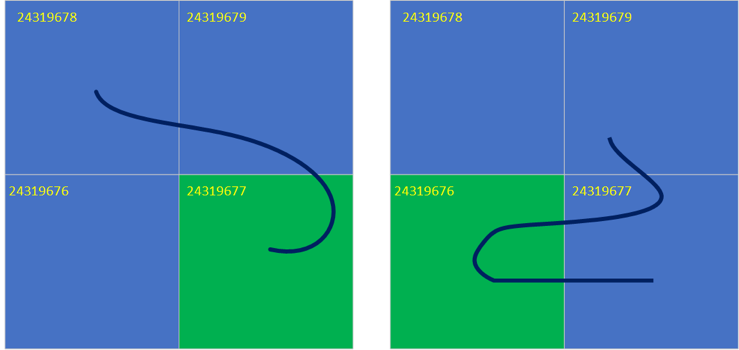
In the following example figures, two linear features span across multiple tiles, with one having its southernmost point in the bottom right tile (figure on the left), and the other having its southernmost point, which is further west, on the bottom left tile. These features live in the corresponding reference tiles, which are tile 24319677 and tile 24319676 respectively.
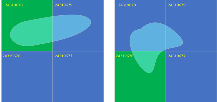
In the following example figures, two polygonal features span across multiple tiles, one having its southernmost point in the top left tile (figure on the left), and the other in the bottom left tile. The data supporting these features lives in the corresponding reference tiles, which are tile 24319678 and tile 24319676 respectively.
In the following real-world example, the data for the highlighted polygon lives in tile 24319671, as the polygon geometry has its southernmost shape point in that tile.