Localization model
Localization objects aren't on the road itself but help a map represent a specific place. Most localization objects are in a "region of interest" within 15 meters of a navigable road, or 20 meters above a road. Landmarks can extend well beyond that range.
Many HERE map products typically include one or more of the following types of localization objects:
- Classified sign faces
- Roadside barriers
- Poles and pole-like objects
- Overhead structure faces
- Landmarks
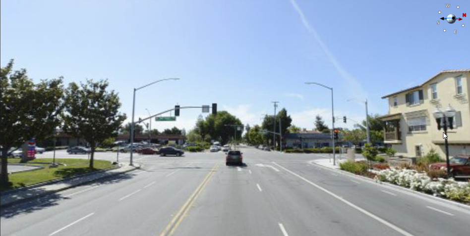
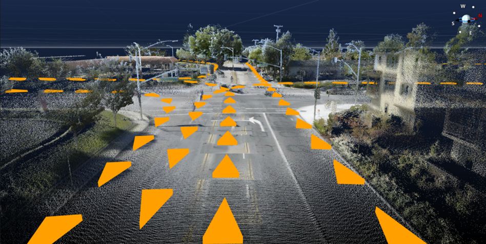
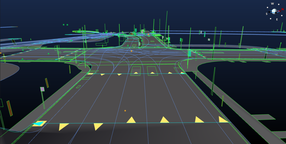
GPS and LiDAR from HERE vehicles, as well as contributions from third parties, collect geolocated data while driving roads. The following three figures show a photo from a vehicle approaching an intersection, LiDAR of the same intersection, road geometry, lane geometry, and localization objects in or near the same intersection after conversion to the Lane Model and Localization Model.
Classified sign faces
A wide variety of road signs appear alongside nearly every road in the world. Some of these signs are merely informational; some provide drivers with essential information such as speed limits.
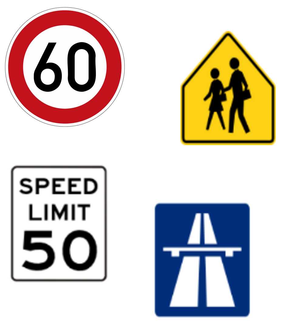
The shape, color, and contents of signs varies greatly by location, even in different states or provinces of the same country. HERE captures these differences via the following parameters:
- Center Point: the latitude, longitude, and elevation at the geometric center of the sign face, not including poles. These values geolocate the sign accurately.
- Color: assorted colors such as white, red, green, blue, brown, yellow, and black help localize signs that can be color-coded in the real world. Values such as Other and Undefined apply in ambiguous cases.
- Shape: supported values include Rectangular, Circular, Triangular, Other, etc.
- Class: each administrative area typically includes numerous classes of signs such as laws, recommendations, and informational signs.
- Road Reference: each sign in the map references a specific topology segment.
Roadside barriers
Barriers are on the sides many roads in the real world. Barriers tend to take different forms in specific places, which makes them useful for localization.
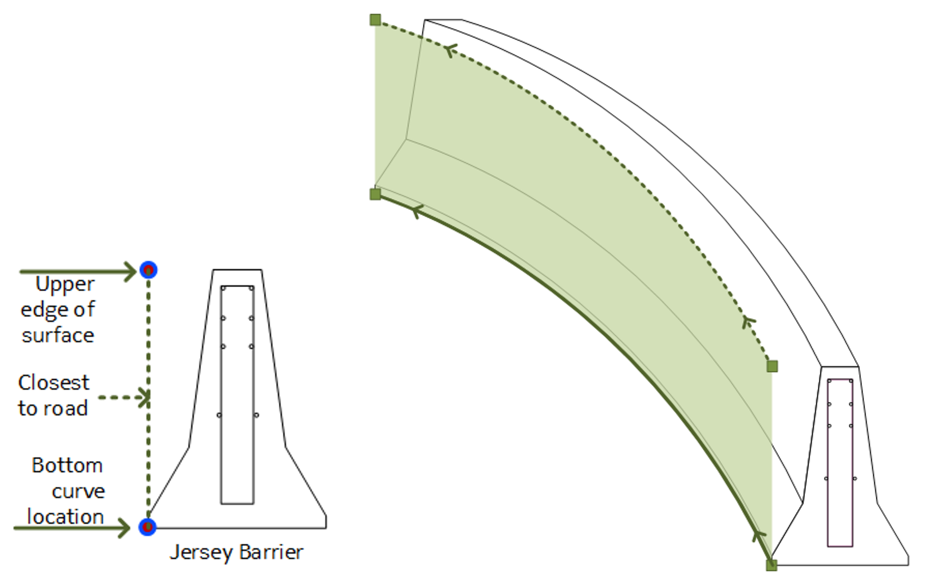
HERE digital maps capture these barriers for several reasons, including localization, using the following parameters:
- Barrier geometry: represented by a 3D spline along the top of the barrier.
- Barrier type: supported types include Jersey barrier, Guardrail, Curb, Wall, Fence, Tunnel Wall, and Unknown.
- Road Reference: each barrier in the map references a specific topology segment.
Poles and pole-like objects
Poles and pole-like objects help with lateral and vertical localization. In HERE Maps, the following parameters help define and localize poles:
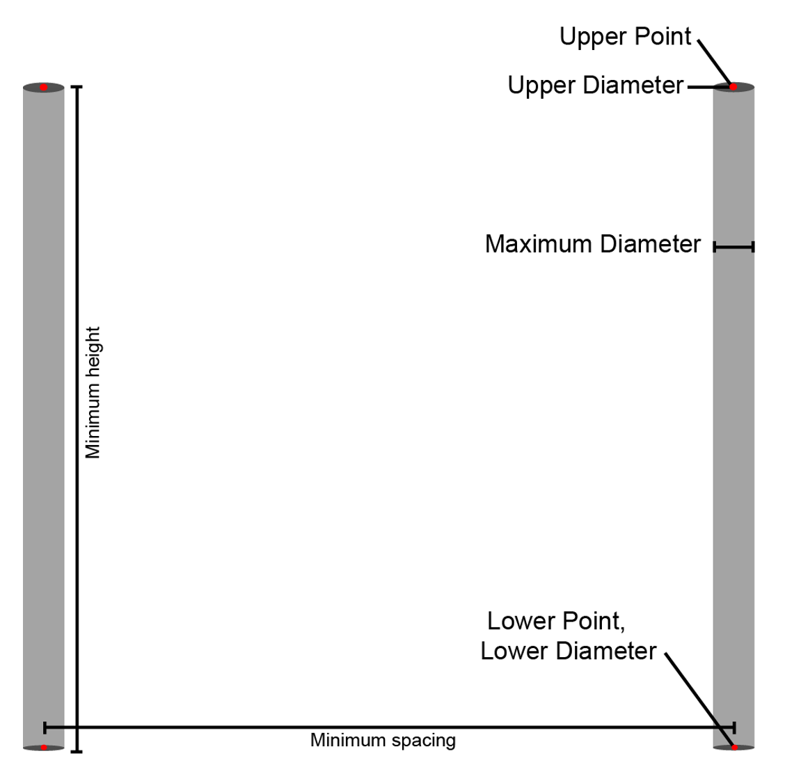
- Upper Point: the 3D point at the top of the pole.
- Upper diameter: the diameter of the pole at the upper point.
- Lower Point: the 3D point at the lowest measurable point of the pole.
- Lower diameter: the diameter of the pole at the lower point.
Overhead structure faces
Overhead structure faces are planar objects positioned roughly perpendicular to the driving direction of the road and above the road surface.
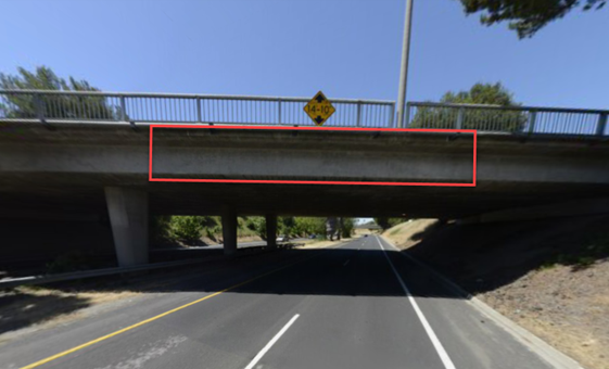
Examples of structure faces include tunnel entrances, overpasses, gantries, and pedestrian bridges that have the following properties:
- Within 30° of perpendicular and 5° of vertical
- Positioned above the road surface
- Have a minimum height and width of 1 meter
- Associated with topology segments passing under the overhead structure face, so you can query for overhead structure faces based on segment ID
- Aligned with the bottom of the object and the upper point heights for each shape point on the bottom line
Landmarks
Landmarks are custom 3D models in the map at the locations of real world landmarks, such as the Eiffel Tower in Paris. Custom landmarks enhance the visual rendering of digital maps, but don't generally affect navigation or routing beyond serving as special points of interest. Most points of interest aren't landmarks.