Water layer
The water layer in the HERE Vector Tile API includes information about various water features such as rivers, lakes, oceans, and other bodies of water. The features of the water layer provide data on the classification and attributes of these features, allowing you to visualize them on a map.
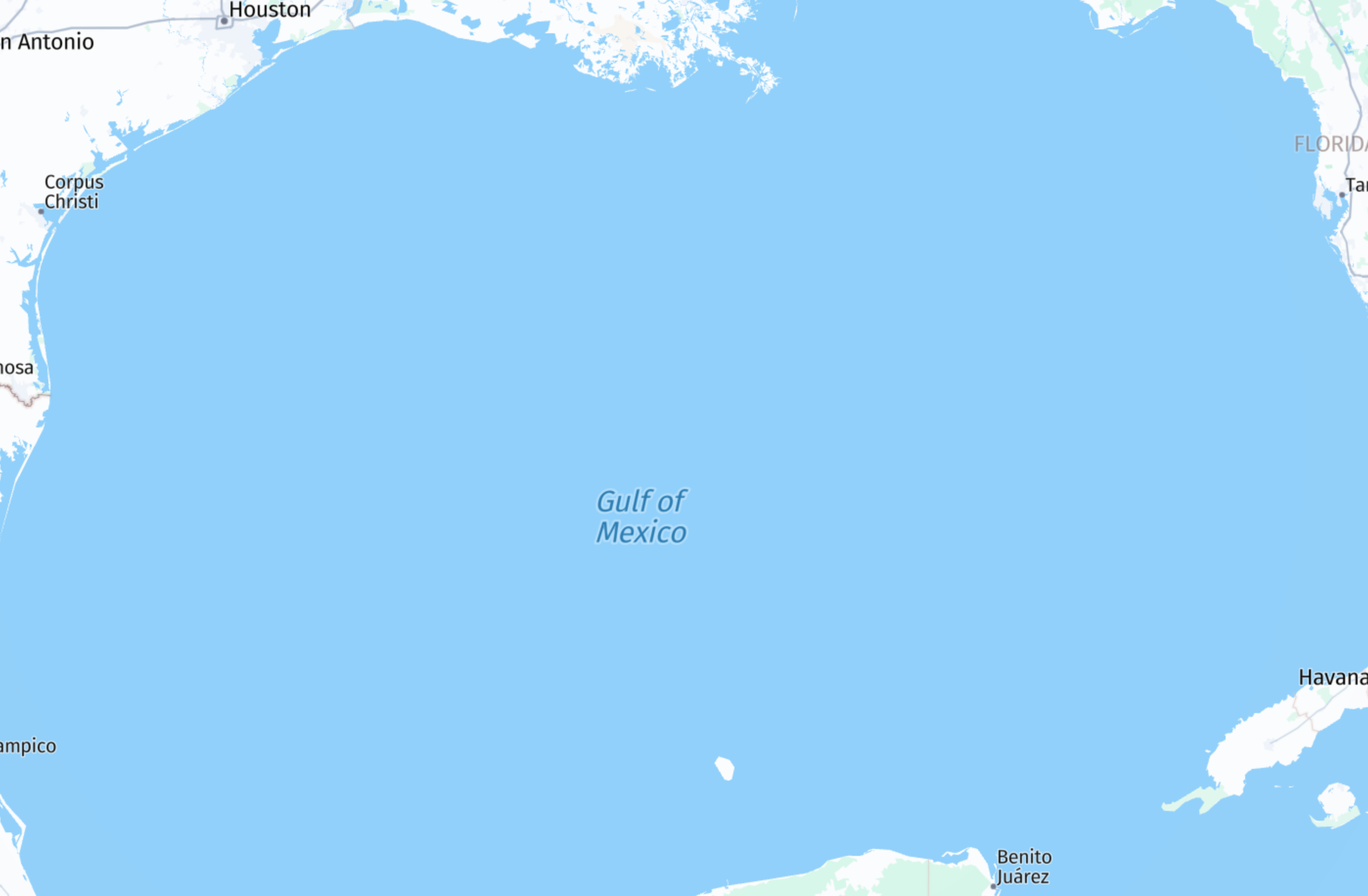
The following figure illustrates sample features of the water layer rendered from the data:
The layer content has the following definition:
- Layer name:
water - Geometry types:
point,line,polygon
The water layer comprises polygon geometries that depict oceans, riverbanks, and lakes. Additionally, it incorporates line geometries representing the centerlines of rivers and streams, as well as point geometries indicating the optimal positions for labeling polygons, ensuring duplication is avoided across tile boundaries.
Shared properties
Every feature in the water layer includes a set of properties that define it, regardless of the specific type of place it represents.
Note
These properties are referred to as
commonproperties in the Tilezen schema. For more information, see Tile layers.
The following properties are used to define a water feature.
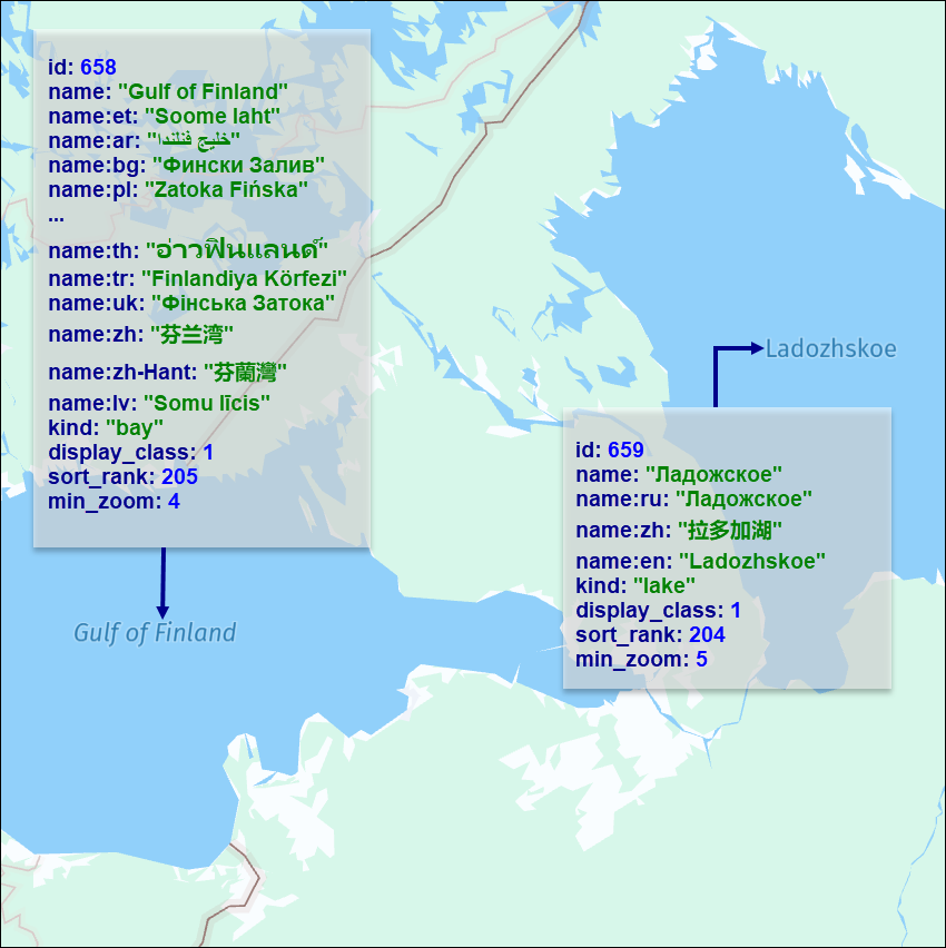
name- The name of the water body. The name might be provided in multiple languages, depending on the available data.id- A unique identifier for thewaterfeature.kind- The general type of water feature. For more information, see Kind definitions and sort ranks. For disputed water feature labels, seekind:xx.sort_rank- A value used to prioritize the display order of different types of water features on the map. A water feature with a highersort_rankvalue is displayed on top of a water feature with a lowersort_rankvalue.min_zoom- The minimum recommended zoom level at which thewaterfeature should be displayed.
Conditional properties
Some water features include properties that are specific only to their corresponding kind.
Note
These properties are referred to as
common-optionalproperties in the Tilezen schema. For more information, see Tile layers.
intermittent:true- This property marks features that sometimes run dry or disappear seasonally. Available only for kindstream.display_class- This property indicates the importance of the correspondingwaterfeature. The value is an integer from 1 (more important) to 8 (less important). Available forlineandpointgeometries.depth- The distance from sea level to the ocean floor. Available for thebathymetrykind only.is_label:true- This property marks linear features which are generated from polygonal geometries. This property is available only for thelinegeometry.kind:xx- Available forpointgeometries. An alternative tokindthat reflects the geopolitical perspective of a country. The full list of available geopolitical views can be retrieved from the service.
To display map features according to a specific political perspective xx, a renderer must utilize kind:xx if available; otherwise, default to kind. For example:
International view:
kind: bay
kind:us=unrecognized_bay
USA view:
kind:us=bayThe following figure shows sample water features rendered on a map together with the associated metadata:
Kind definitions and sort ranks
The kind parameter in the water layer describes the specific classification or category of a water feature. For example, the kind parameter might indicate whether a feature is a river, lake, ocean, canal, bay, swimming pool, and so on. The kind property helps to categorize and differentiate different types of water bodies or water-related elements on a map.
water(sort_rank: 200) - polygonfjord(sort_rank: 200) - pointsea(sort_rank: 200) - pointstrait(sort_rank: 200) - pointriver(sort_rank: 201) - line or pointstream(sort_rank: 201) - linecanal(sort_rank: 201) - linelake(sort_rank: 204) -linebay(sort_rank: 205) - pointocean(sort_rank: 205) - pointbathymetry(sort_rank: 206) - polygonswimming_pool(sort_rank: 415) - polygon
Water kind:xx Values
kind:xx Valuesfjordseastraitriverbayoceanunrecognized_fjordunrecognized_seaunrecognized_straitunrecognized_riverunrecognized_bayunrecognized_ocean
Note
All polygons correspond to
waterwhile points and lines are used for labeling.
Next steps
- For more information about other layer feature types available in the HERE Vector Tile API, see Tile Layers.
Updated 7 days ago