Introduction
The HERE Raster Tile API enables seamless integration of raster map imagery into various platforms and frameworks such as HERE SDK, HERE Maps API for JavaScript and others by passing templated raster tile URLs to the chosen mapping library, simplifying integration and ensuring efficient map rendering without manual tile management.
By leveraging pre-defined styles and a variety of features, the API allows developers to customize the map's appearance to meet specific requirements and display detailed maps at different zoom levels.
The following figure shows examples of map styles available in the HERE Raster Tile API:
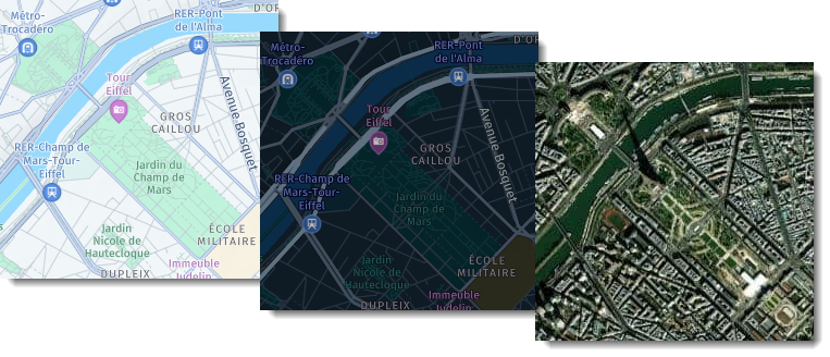
The HERE Raster Tile API offers bitmap images with a resolution of either 256x256 or 512x512 pixels, optimized for web and mobile screens.
If you need to customize the map further, the API allows you to specify additional features to be visible or remove features you don't want to see by using the features parameter. For example, by using features=congestion_zones:all, you can show all congestion zones, or by using features=pois:disabled, you can hide all points of interest.
Additionally, the HERE Raster Tile API provides a resource parameter that defines what type of basic geometric shapes (called "draw primitives") the map uses to represent areas, text, and lines. For example, you can request the background resource, containing areas and lines, then draw your own lines for traffic and text on top. This ensures that traffic does not overlap text but is still on top of the background.
For logistics and transportation industry users, the HERE Raster Tile API provides truck restriction map tiles under the Advanced Raster Tile pricing plan. These map tiles offer a detailed view of truck restrictions, which simplifies planning and route optimization.
Example: Environmental zones, congestion zones, and restricted areas
The following example uses the HERE Raster Tile API to display environmental zones, congestion zones, and traffic restrictions on the map.
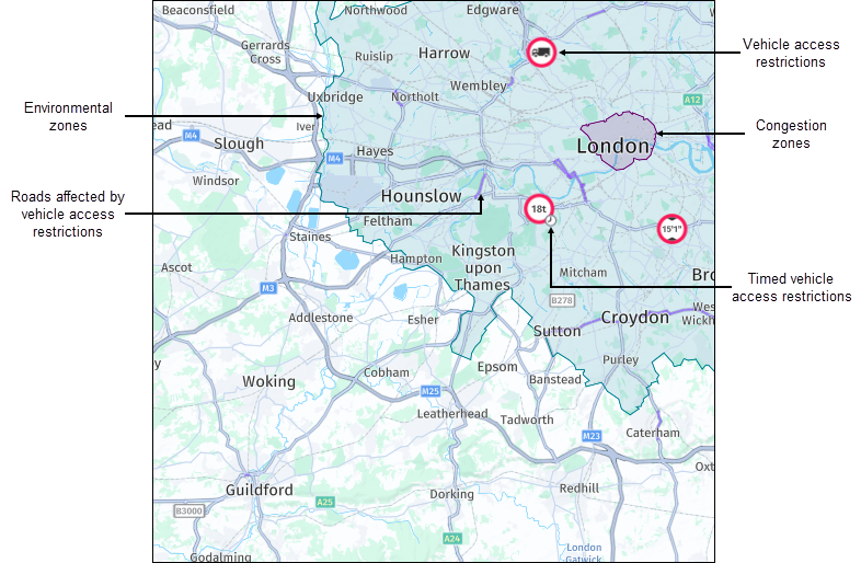
An environmental zone is an area where access is restricted to vehicles that meet specific emissions standards. The purpose of the zone is to improve air quality by regulating the exhaust gases emitted by cars. Usually, to enter the zone, motor vehicle drivers must have a valid sticker visible on their vehicle that corresponds to the qualifying plate. Motorcycles and vehicles with special rights are exempt from this regulation.
Congestion zones indicate areas where drivers are required to pay a fee to enter or drive through during certain times of day.
By including this information on a map, truck fleet managers can plan their routes accordingly to avoid additional fees, potential fines or penalties for violating regulations.
Next steps
- To get hands-on experience with the HERE Raster Tile API, see the Get started guide.
- To learn more about HERE Raster Tile API endpoints and parameters, see the API Reference documentation.