

boundaries
Content: default
Geometry: line
Zoom: 0–17
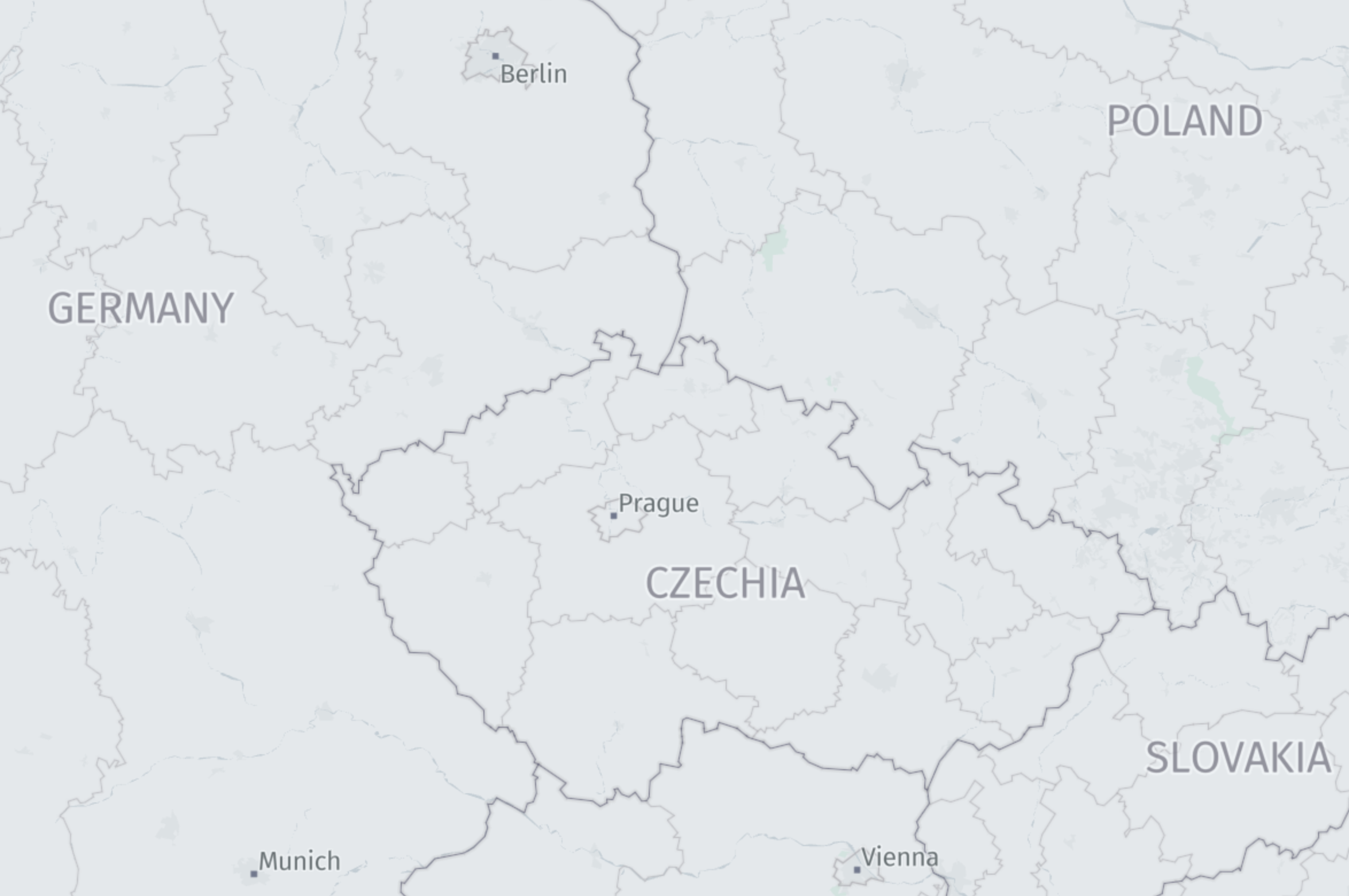
The following figure illustrates an example of boundaries.
Properties
kind | kind:{country_code} | kind_detail | border_style | name:left | name:right | name:left:{language_code} | name:right:{language_code}
Common properties
Common properties specific to Japan - core map
kind
Type: string
Optional
Boundaries can be one of the options listed below. For disputed borders, see kind:{country_code}. When kind:{country_code} is present, kind may be absent.
Values
| Value | Zoom | Description |
|---|---|---|
country | 0–17 | National boundary line. |
disputed | 0–17 | Boundary where two or more countries have conflicting territorial claims. |
region | 2–17 | Regional boundary such as a state or province. |
Values specific to Japan - core map
| Value | Zoom | Description |
|---|---|---|
locality | 9–17 | City boundary in Japan, corresponding to admin_level=7 in OpenStreetMap. |
oaza | 13–17 | Subdistrict boundary in Japan. An ōaza is a large rural subdivision within a Japanese municipality. |
aza | 14–17 | Small administrative zone boundary in Japan. An aza is a subdivision within an ōaza. |
block | 15–17 | Block boundary in Japan. |
kind:{country_code}
Type: string
Present when kind_detail is: 2, 4
An alternate for kind according to the geopolitical view of a country.
| Value | Description |
|---|---|
country | National boundary line from the perspective of the given country's viewpoint. |
disputed | Disputed boundary from the perspective of the given country's viewpoint. |
region | Regional boundary from the perspective of the given country's viewpoint. |
unrecognized_country | A line treated as a country boundary in the default international view, but not recognized as such from the given country's viewpoint. |
unrecognized_disputed | A line treated as disputed in the default international view, but reclassified from the perspective of the given country's viewpoint. |
unrecognized_region | A line treated as a regional boundary in the default international view, but not recognized as such from the given country's viewpoint. |
kind_detail
Type: int
Always present
This is an integer that maps kind to more specific information about the feature.
Values
Values specific to Japan - core map
border_style
Type: string
Always present
Defines which pre-defined style should be applied when visualizing borders based on the map's political view.
| Value | Description | Associated kind |
|---|---|---|
dashed | Dashed line style, used for unresolved or ceasefire boundary lines. | unrecognized_country, unrecognized_disputed, unrecognized_region |
dotted | Dotted line style, used for disputed boundary lines. | disputed |
solid | Solid line style, used for internationally established boundary lines. | country |
undefined | Border style is not defined. |
name:left
Type: string
Present when kind_detail is: 2, 4
The name to display on the left side of the border when traversing the line geometry from start to end. For more information, see Feature names.
name:right
Type: string
Present when kind_detail is: 2, 4
The name to display on the right side of the border when traversing the line geometry from start to end. For more information, see Feature names.
name:left:{language_code}
Type: string
Present when kind_detail is: 2, 4
The localized name to display on the left side of the border. For more information, see Name localization.
name:right:{language_code}
Type: string
Present when kind_detail is: 2, 4
The localized name to display on the right side of the border. For more information, see Name localization.
Common properties
min_zoom
See min_zoom.
sort_rank
Type: int
Always present
The ordering of features, which determines which features are rendered "on top of" other features, can be an important issue when rendering maps. To assist map rendering, there is a sort_rank property on some features that suggests in what order the features should appear.
A feature with a higher sort_rank value is displayed on top of feature with a lower sort_rank value.
Values
Values specific to Japan - core map
Common properties specific to Japan - core map
source
See source.
Updated 4 months ago