Define the map styles
Deprecation notice
The PNG and PNG8 image formats are being deprecated for all satellite-based styles within the HERE Map Image API v3. This change applies specifically to styles featuring satellite imagery, including
satellite.day,explore.satellite.day,lite.satellite.day, andlogistics.satellite.day.This deprecation applies when the resource parameter is set to
baseorbackground. Instead of PNG or PNG8, use the JPEG format for these scenarios. Effective September 2026, while requests specifying PNG/PNG8 will not trigger an immediate failure, the service will automatically return JPEG-compressed tiles.
The HERE Map Image API provides access to a range of map styles, enabling you to customize the visual appearance of maps according to specific needs and preferences. These styles offer flexibility in highlighting particular elements like roads and landmarks, aligning with different use cases. By customizing styles, you can craft seamless map experiences that improve usability and engage users effectively.
Explore the HERE Map Image API v3 with this interactive example. Test parameters and see real-time results:
Try It OutOptional: Get the list of the available map styles
To obtain the current list of the HERE Map Image API map styles, make a request to the /info endpoint, as shown in the following example:
https://image.maps.hereapi.com/mia/v3/info
?apiKey={YOUR_API_KEY}Result: The API responds with a JSON file that lists the supported map styles in the resources array, as shown in the following example:
{
  ...
  "styles": [
    "explore.day",
    "explore.night",
    "explore.satellite.day",
    "lite.day",
    "lite.night",
    "lite.satellite.day",
    "logistics.day",
    "logistics.night",
    "logistics.satellite.day",
    "satellite.day",
    "topo.day",
    "topo.night"
  ],
  ...
}
You can use any of the values in the returned array to specify the style to apply on your map images.
Select the style for your map images
Perform the following steps to modify the visual appearance of your map images through the style parameter.
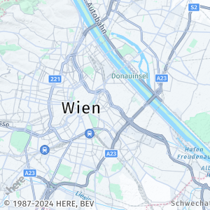
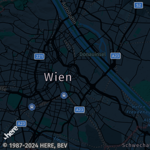
explore.day
This default map style is tailored for daytime exploration and outdoor activities. It prioritizes landmarks, points of interest, and natural features to enrich the exploration experience.
Sample request:
https://image.maps.hereapi.com/mia/v3/base/mc/center:48.203811,16.392129;zoom=11/300x300/png8
?apikey={YOUR_API_KEY}Response:
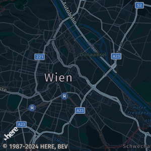
explore.night
A map style tailored for nighttime exploration or navigation. It features a darker color scheme for low-light environments.
Sample request:
https://image.maps.hereapi.com/mia/v3/base/mc/center:48.203811,16.392129;zoom=11/300x300/png8
?apikey={YOUR_API_KEY}
&style=explore.nightResponse:
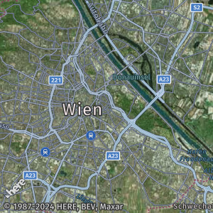
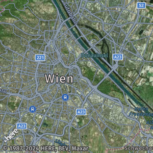
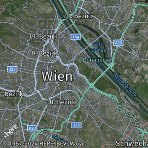
explore.satellite.day
This hybrid map style combines satellite imagery with additional cartographic features for daytime exploration. It overlays labels, points of interest, and other annotations onto the satellite imagery for a comprehensive view.
Sample request:
https://image.maps.hereapi.com/mia/v3/base/mc/center:48.203811,16.392129;zoom=11/300x300/jpeg
?apikey={YOUR_API_KEY}
&style=explore.satellite.dayResponse:
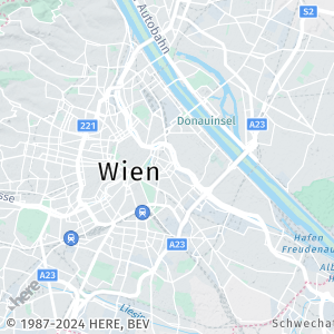
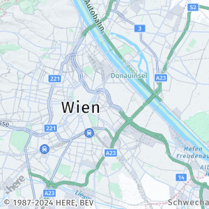
lite.day
This lighter and minimalist map style is optimized for daytime use. It reduces emphasis on intricate road details, making it easier to overlay additional information or custom layers onto the map.
Sample request:
https://image.maps.hereapi.com/mia/v3/base/mc/center:48.203811,16.392129;zoom=11/300x300/png8
?apikey={YOUR_API_KEY}
&style=lite.dayResponse:
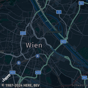
lite.night
This map style is specifically designed for nighttime exploration or navigation. It utilizes a darker color scheme suitable for low-light environments, with adjustments made to the color scheme of point and line features to accommodate overlaying additional data.
Sample request:
https://image.maps.hereapi.com/mia/v3/base/mc/center:48.203811,16.392129;zoom=11/300x300/png8
?apikey={YOUR_API_KEY}
&style=lite.nightResponse:
logistics.day
This style is optimized to provide clear and relevant information for efficient route planning, navigation, and logistics operations.
Sample request:
https://image.maps.hereapi.com/mia/v3/base/mc/center:48.203811,16.392129;zoom=11/300x300/png8
?apikey={YOUR_API_KEY}
&style=logistics.dayResponse:
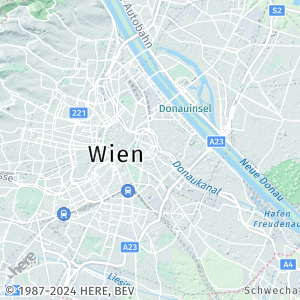
lite.satellite.day
A hybrid map design that blends daytime satellite imagery with point and line features. This style optimizes the color scheme of these features to provide a background for overlaying additional data.
Sample request:
https://image.maps.hereapi.com/mia/v3/base/mc/center:48.203811,16.392129;zoom=11/300x300/jpeg
?apikey={YOUR_API_KEY}
&style=lite.satellite.dayResponse:
logistics.night
This style is adjusted for night-time or low-light logistics operations.
Sample request:
https://image.maps.hereapi.com/mia/v3/base/mc/center:48.203811,16.392129;zoom=11/300x300/png8
?apikey={YOUR_API_KEY}
&style=logistics.nightResponse:
logistics.satellite.day
This style provides information related to route planning, navigation, and logistics operations, overlaid onto real-world, satellite imagery.
Sample request:
https://image.maps.hereapi.com/mia/v3/base/mc/center:48.203811,16.392129;zoom=11/300x300/jpeg
?apikey={YOUR_API_KEY}
&style=logistics.satellite.dayResponse:
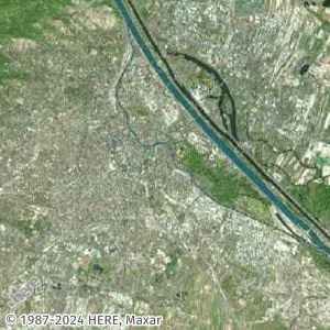
satellite.day
This map style presents high-resolution satellite imagery. It doesn't incorporate labels or points of interest (POIs), concentrating solely on offering a visual representation of the Earth's surface from above.
Note
The
satellite.daystyle doesn't support thefeaturesparameter.
Sample request:
https://image.maps.hereapi.com/mia/v3/base/mc/center:48.203811,16.392129;zoom=11/300x300/jpeg
?apikey={YOUR_API_KEY}
&style=satellite.dayResponse:
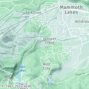
topo.day
A map style that focuses on rendering and highlighting such geographic features as elevation, landforms, and natural landscapes to provide a clear representation of the terrain.
Sample request #1:
https://image.maps.hereapi.com/mia/v3/base/mc/center:48.203811,16.392129;zoom=11/300x300/png8
?apikey={YOUR_API_KEY}
&style=topo.dayResponse:
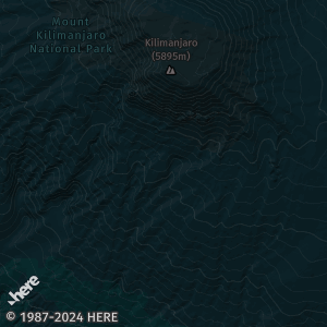
Sample request #2:
Because this style is optimized for showcasing terrain-related information in a clear and visually appealing manner, it is best suited for applications related to hiking, biking, skiing, or any outdoor activities. The following request provides another example of the topo.day style used to provide a detailed terrain view:
https://image.maps.hereapi.com/mia/v3/base/mc/center:37.632691,-118.993449;zoom=13/300x300/png8
?apikey={YOUR_API_KEY}
&style=topo.dayResponse:
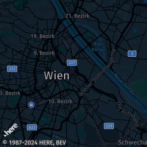
topo.night
Similarly to the topo.day style, the topo.night style focuses on rendering and highlighting elevation, landforms, and natural landscapes, however, with the focus on enhanced usability and functionality in low-light environments.
Sample request #1:
https://image.maps.hereapi.com/mia/v3/base/mc/center:48.203811,16.392129;zoom=11/300x300/png8
?apikey={YOUR_API_KEY}
&style=topo.nightResponse:
Sample request #2:
The following request provides another example of the topo.night style used to provide a detailed terrain view:
https://image.maps.hereapi.com/mia/v3/base/mc/center:-3.105161,37.351017;zoom=12/300x300/png8
?apikey={YOUR_API_KEY}
&style=topo.nightResponse:
Combine the map style with other features
By combining map styles, you can create a customized map that caters to the preferences and needs of your target audience. Different users, such as tourists, hikers, drivers, or urban planners, may require distinct map styles to access relevant information.
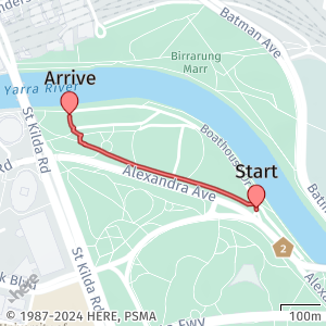
Example: lite.day and custom overlay
By utilizing the lite.day map style in conjunction with the GeoJSON format, your application can achieve a visually clean and uncluttered map interface. This combination allows the user's attention to be directed towards attractions, landmarks, and other points of interest, while avoiding an overwhelming display of road details. Furthermore, the lighter colors of the map style enable clear distinction and visibility of GeoJSON objects overlaid on the map.
For example, see the following request that combines various HERE Map Image API features, including the lite.day style and encoded GeoJSON objects:
https://image.maps.hereapi.com/mia/v3/base/mc/overlay:padding=64/300x300/png
?apiKey={YOUR_HERE_APIKEY}
&overlay=point:-37.82189,144.97493;label=Start|-37.8198108,144.9696615;label=Arrive|size=large
&overlay=line:BGj8ukoCklyw0IsET4DnBTjNoGrOgFjNsEjN0FvRoGrYkDrOkDvMwC7LwCzKwCvM0FrY4D_OwC7L8Qv0BsEzKwC7G0FrTsEzKoGTkDwCUjD0FnL4DoB8BjDwC7BoG7BgFTSE
&features=pois:disabled
&style=lite.day
&scaleBar=kmResult: The request retrieves the following map image, with GeoJSON features clearly distinguishable on a map rendered with the lite.day style:
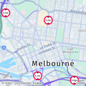
Example: logistics.day and vehicle restrictions
When you combine the logistics.day style with vehicle restriction data, you can display maps optimized for heavy goods vehicles, while ensuring that the maps also highlight roads with legal and practical limitations.
Consider the following request:
https://image.maps.hereapi.com/mia/v3/base/mc/center:-37.807832,144.961527;zoom=13/480x370/png
?apiKey={YOUR_API_KEY}
&features=pois:disabled,vehicle_restrictions:active_and_inactive
&style=logistics.day
&scaleBar=kmResult: The request from the preceding example combines the logistics.day style and the vehicle restrictions feature to supplement a map view optimized for logistics with additional data about vehicle limitations:
Next steps
To explore all supported endpoints and parameters, see the API Reference.