

places
Content: default
Geometry: point
Zoom: 0–17
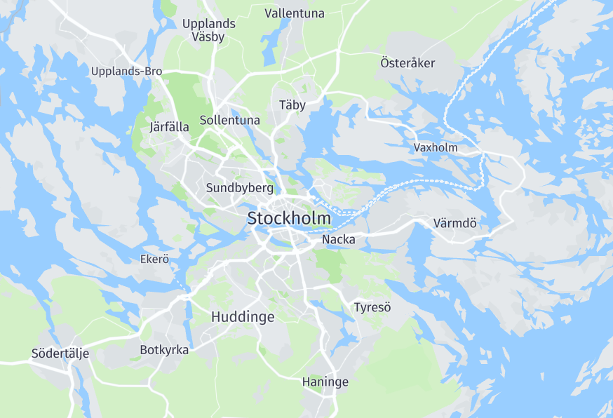
The places layer in the HERE Vector Tile API contains features for administrative names such as countries, regions, cities, and other labels like states or provinces within a country as point geometry types. This layer also shows the names of neighborhoods and districts in a city.
In addition to the names of administrative regions, the places layer includes features like region type (for example, country, state, province), population, area, and other relevant information. You can use this data to create advanced applications like tools to study demographic trends, visualize election results, or analyze economic data.
The following figure illustrates sample features of the places layer rendered from the data:
Properties
kind | kind:{country_code} | kind_detail | supercity | country_capital | county_capital | region_capital | area_rank | population | iso_code | name | name:short | name:latin | translit:{language_code} | name:{language_code}
Common properties
Common properties specific to Japan - core map
kind
Type: string
Optional
The general type of place. For more information, see Kind definitions and examples.
Values
| Value | Zoom | Description |
|---|---|---|
borough | 3–17 | This value is used for features that represent smaller administrative divisions within a city or other locality. Examples include Soho and Waterloo in London, or Scarborough and North York in Toronto. |
country | 1–6 | This value is used for features that represent entire countries. Examples include the United States, Canada, and Mexico. |
locality | 0–17 | This value is used for features that represent cities, towns, and other populated places. Examples include New York City, Los Angeles, and Chicago in the United States, or Toronto, Montreal, and Vancouver in Canada. |
neighbourhood | 8–17 | This value is used for features that represent specific neighborhoods or districts within a city or other locality. Examples include SoHo in New York City, or Kitsilano in Vancouver. |
region | 3–13 | This value is used for features that represent larger regions, states, or provinces within a country. Examples include California, New York, and Texas in the United States, or Ontario, Quebec, and British Columbia in Canada. |
Values specific to Japan - core map
| Value | Zoom | Description |
|---|---|---|
aza | 12–17 | Refers to administrative units within a locality such as block numbers or small villages. The term \"aza\" is used in Japan to denote small administrative areas. |
microhood | 14–17 | Refers to administrative units within a locality such as block or parcel numbers. |
oaza | 12–17 | Refers to subdistricts within a larger locality, typically used in Japan to describe rural areas. |
kind:{country_code}
Type: string
Optional
An alternate for kind according to the geopolitical viewpoint of a country.
The following are code examples of the Cyprus labels in different viewpoints.
International view:
kind: country
kind:cy: unrecognized_country
Cyprus view:
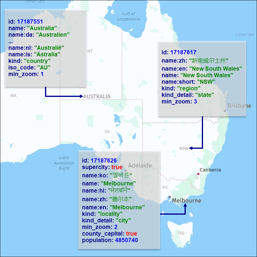
kind:cy: countryThe following figure shows sample places features rendered on a map together with the associated metadata:
kind_detail
Type: string
Optional
This property provides additional details about the kind of place, such as the specific type of locality or region. Examples of values for kind_detail include state, province, municipality, neighborhood, and so on. For more information, see Additional information for different kind categories.
Values
| Value | Description | Associated kind |
|---|---|---|
city | For a place with a population of 100,000 or more. | locality |
hamlet | For a place with a population of 200 or fewer, or a hamlet source data subtype. | locality |
locality | For a place with no population and no data hints for label type. | locality |
microhood | Indicates a sub-neighbourhood administrative unit, representing a very small area such as a block or parcel. | neighbourhood |
state | For a state-level region. | region |
town | For a place with a population of 10,001 up to 100,000. | locality |
village | For a place with a population of 201 up to 10,000. | locality |
Values specific to Japan - core map
supercity
Type: flag
Present when kind is: locality · Present when kind_detail is: city
This property is true for important cities that are recommended to be always displayed on all zoom levels. This property is not present when its value is false.
country_capital
Type: flag
Present when kind_detail is: city, hamlet, locality, town, village
This property is true for country capitals and applies only to features with kind value of locality.
county_capital
Type: flag
Present when kind_detail is: city, hamlet, locality, town, village
This property is true for county capitals and applies only to features with kind value of locality.
region_capital
Type: flag
Present when kind_detail is: city, locality, town, village
This property is true for state capitals and applies only to features with kind value of locality.
area_rank
Type: int
Range: ≥ 0
Present when kind is: country
This property holds an integer value representing the area of a related country. This property applies exclusively to features whose kind value is country.
population
Type: int
Present when kind is: locality, borough
This property represents the population count of the specified location.
iso_code
Type: string
Optional
This property contains the ISO 3166-1 alpha-2 two-letter country code and applies only to features with kind value of country.
name
Type: string
Always present
The common local name for the place feature, in the local language script. For more information, see Feature names.
name:short
Type: string
Present when kind_detail is: city, state, town, village
The short name of the place feature. For more information, see Feature names.
Example values: AK(Alaska), BA(Buenos Aires), NYC(New York City)
name:latin
Type: string
Optional
The Latin script version of the name. Contains the same value as name if name is in Latin script, or name:{language_code} where {language_code} is one of the fallback languages in Latin script. For more information, see Name localization.
translit:{language_code}
Type: string
Optional
The localized transliteration of the default name (name). For more information, see Name localization.
name:{language_code}
Type: string
Optional
The name of the feature in the specified language. If no data is available for the requested language code, the value may be compiled from an English or Latin transliteration of existing language representations. For more information, see Name localization.
Common properties
min_zoom
See min_zoom.
Common properties specific to Japan - core map
source
See source.
Updated 2 months ago