Can I integrate HERE Map with Leaflet?
Yes — it is possible to use HERE Location Services / HERE Maps with Leaflet, and this is a supported and common integration pattern.
However, there are important architectural constraints to be clear about first.
---
Integration Options (What is and is not possible)
---------------------------------------------------------
### ✅ Supported
Use Leaflet as the map framework
Use HERE map tiles (raster or vector via raster fallback) as a tile layer
Use HERE Location Services APIs (Routing, Geocoding, Isoline, etc.) together with Leaflet for visualization
### ❌ Not Supported
You cannot embed Maps API for JavaScript (H.Map) inside Leaflet
+ Maps API for JavaScript is a standalone rendering engine
+ Leaflet and HERE Maps JS both want full control of the map container
So the correct pattern is:
> Leaflet for rendering + HERE Map Tiles + HERE REST APIs
---
High-level Architecture
---------------------------<br />Browser ├─ Leaflet (map rendering, interaction) ├─ HERE Map Tiles (basemap) └─ HERE Location Services APIs ├─ Routing API v8 ├─ Geocoding & Search v7 ├─ Isoline API └─ etc.<br />
---
HERE Base Map Demo: Show HERE Maps in Leaflet
-------------------------------------------------
This demo:
Uses Leaflet
Uses HERE raster map tiles
Shows a HERE basemap only
---
Prerequisites - Get HERE API Key
------------------------------------
From HERE Platform Portal: https://platform.here.com open Launcher > Access Manager > Create or open your app
You need to copy an existing or create a new API Key (sufficient for this demo)
---
Project Structure
---------------------<br />here-leaflet-demo/ ├─ index.html<br />
That’s all you need for a minimal demo.
---index.html – Minimal Working Example
------------------------------------------<br /><br />HERE Maps + Leaflet Demo<br /><br />rel="stylesheet" <br /> href="[https://unpkg.com/[email protected]/dist/leaflet.css](https://unpkg.com/[email protected]/dist/leaflet.css/)" <br /> /><br /><br />
Replace "your_here_api_key" with your real key, then run % python3 -m http.server 8000 under your project root.
Open browser and navigate to localhost or 127.0.0.1 then you should see a HERE basemap rendered by Leaflet as follows: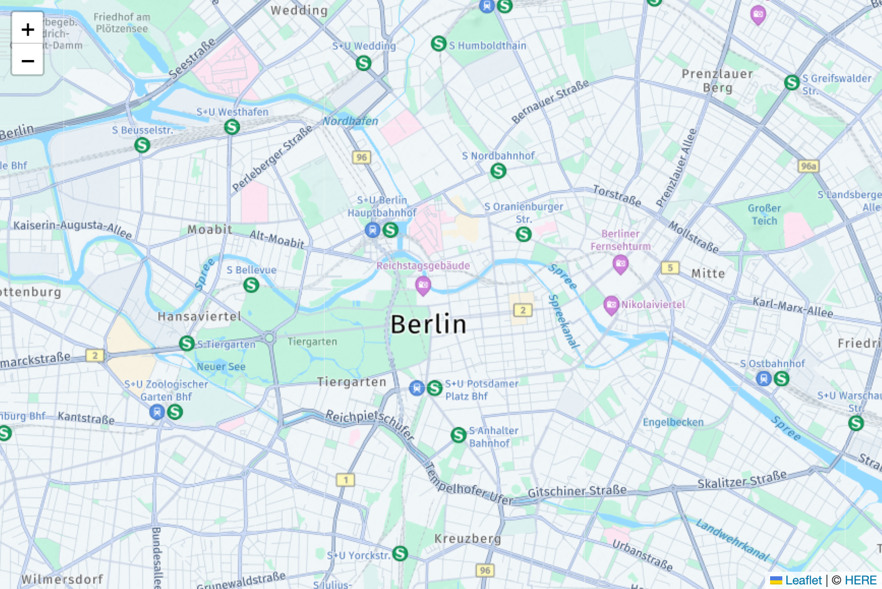
---
Switching HERE Map Styles
-----------------------------
Change the map style by referring to the available styles at https://maps.hereapi.com/v3/info?apiKey=YOUR_HERE_API_KEY
| Style value | Style name | Description |
| --- | --- | --- |
| explore.day | Explore (Day) | Default full‑detail daytime map style for general navigation and map display. Balanced labeling, roads, land use, and POIs. |
| explore.night | Explore (Night) | Night / low‑light optimized variant of Explore. Reduced brightness and contrast for nighttime use. |
| lite.day | Lite (Day) | Lightweight daytime style optimized as a background for overlays (routes, polygons, custom layers). Visual emphasis on roads is reduced. |
| lite.night | Lite (Night) | Night‑mode version of Lite. Suitable for overlay‑heavy maps in low‑light environments. |
| topo.day | Topographic (Day) | Terrain‑focused style highlighting elevation, landforms, and natural features. Suitable for outdoor, hiking, or recreation use cases. |
| topo.night | Topographic (Night) | Night‑mode version of Topographic, preserving terrain visibility with low‑light optimized colors. |
| logistics.day | Logistics (Day) | Logistics‑optimized style for routing, navigation, and fleet use cases. Supports advanced content such as vehicle restrictions. (Advanced / paid) |
| logistics.night | Logistics (Night) | Night‑mode logistics style for low‑light fleet and transportation operations. (Advanced / paid) |
| satellite.day | Satellite | High‑resolution satellite imagery without map labels. |
| explore.satellite.day | Hybrid (Satellite + Labels) | Satellite imagery with labels, roads, and place names overlaid for easier interpretation. |
Example: replace explore.day with topo.night in the demo code and you will get the following result: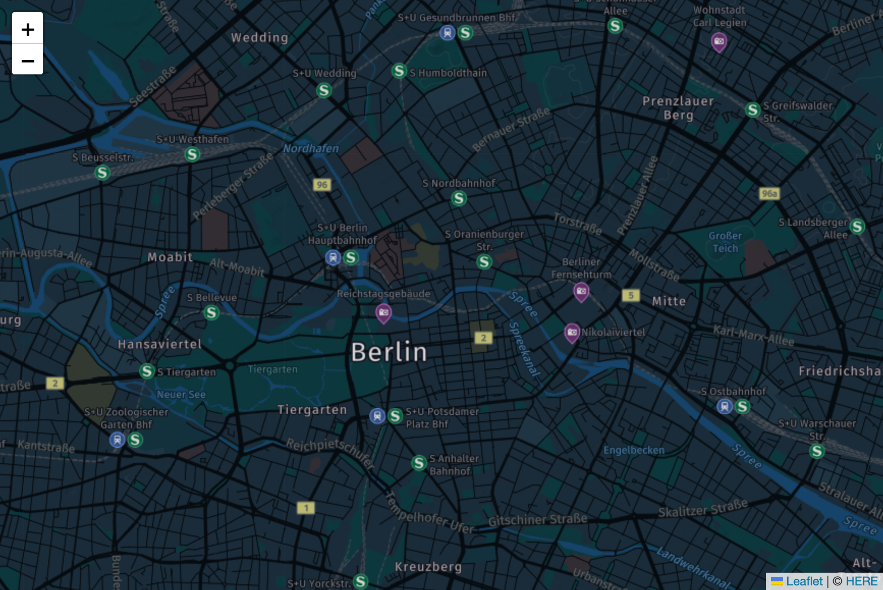
---
HERE Location Service Demo: Show HERE Maps with Routing in Leaflet
----------------------------------------------------------------------
Revise the index.html file as follows to add a routing feature - calcualte and present route on HERE map<br /><br />HERE Routing API v8 + Leaflet<br /><br />rel="stylesheet" <br /> href="[https://unpkg.com/[email protected]/dist/leaflet.css](https://unpkg.com/[email protected]/dist/leaflet.css/)" <br /> /><br /><br />
You can get some route as follows, feel free to change the "origin" and "destination" to get another result: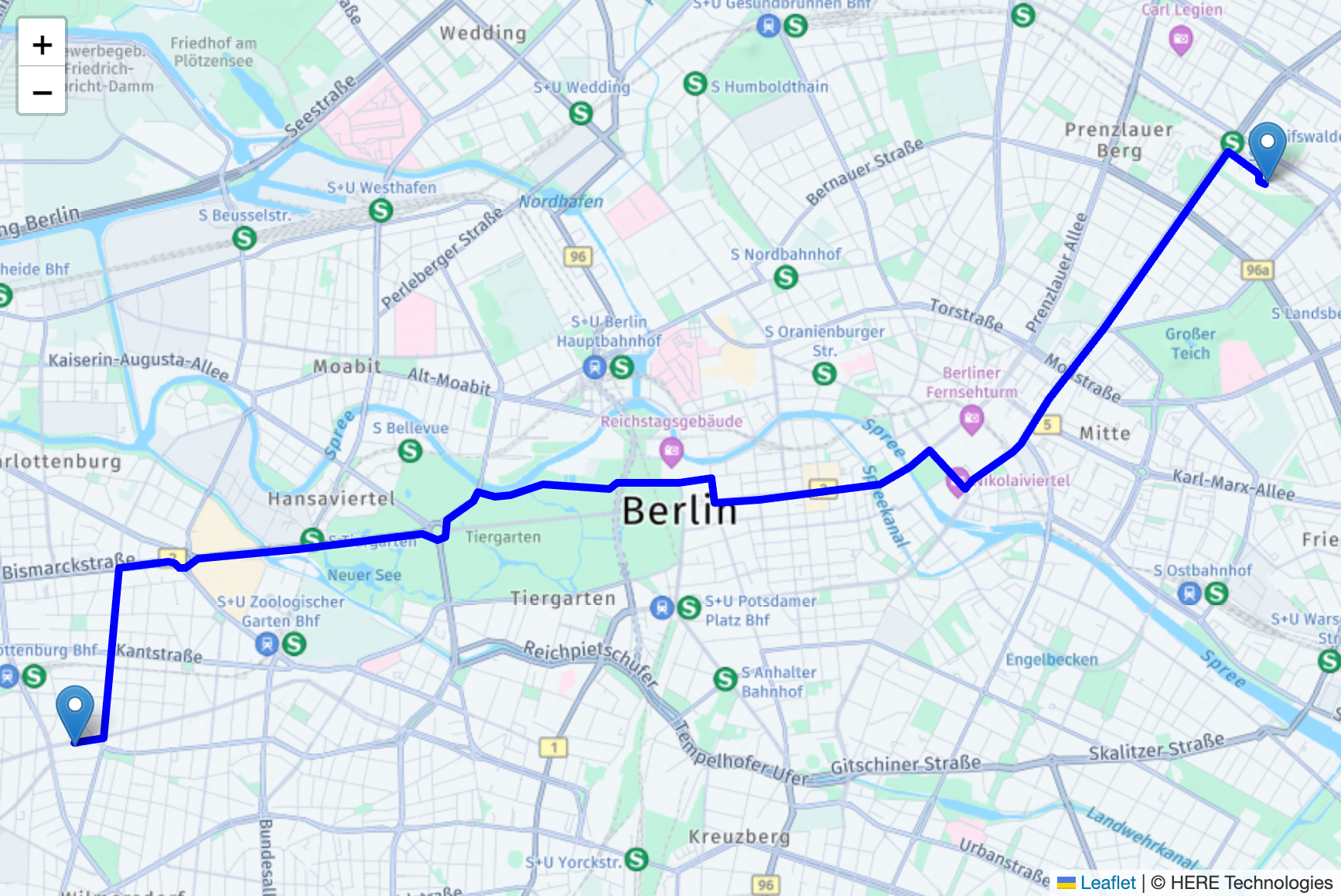
---
Why NOT Maps API for JavaScript Inside Leaflet?
---------------------------------------------------
Important clarification you may need:
Maps API for JavaScript:
+ Owns HARP rendering pipeline
+ Owns camera, tilt, pitch, gestures
Leaflet:
+ Owns DOM container and interaction system
Running both in one container causes conflicting rendering and event handling
That’s why HERE does not support mounting H.Map as a Leaflet layer.
---
When to Use Which Approach
------------------------------
| Use case | Recommended |
| --- | --- |
| Lightweight map + custom overlays | Leaflet + HERE tiles |
| Full HERE features (3D, tilt, advanced styling) | HERE Maps API for JS |
| Routing, geocoding, isolines | HERE REST APIs + Leaflet |
| Offline / native apps | HERE SDKs |
Summary
-----------
Yes, integration of HERE Map with Leaflet is possible
Correct pattern: Leaflet + HERE Map Tiles + HERE REST APIs
Not supported: Embedding HERE Maps JS inside Leaflet