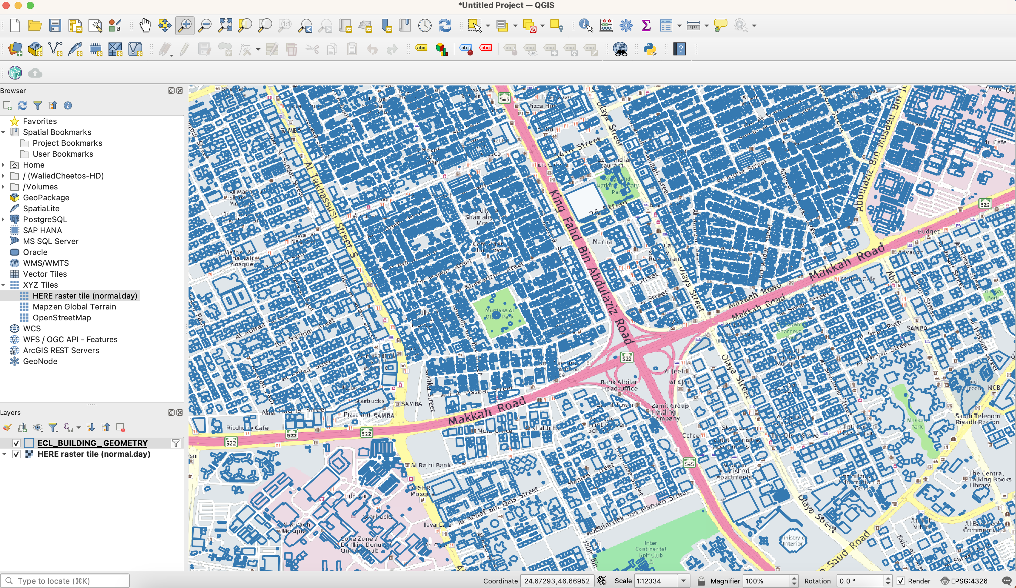
How to load and explore HERE Enhanced Cartographic Layer (ECL) – Building Footprints
How to load and explore HERE Enhanced Cartographic Layer (ECL) – Building Footprints
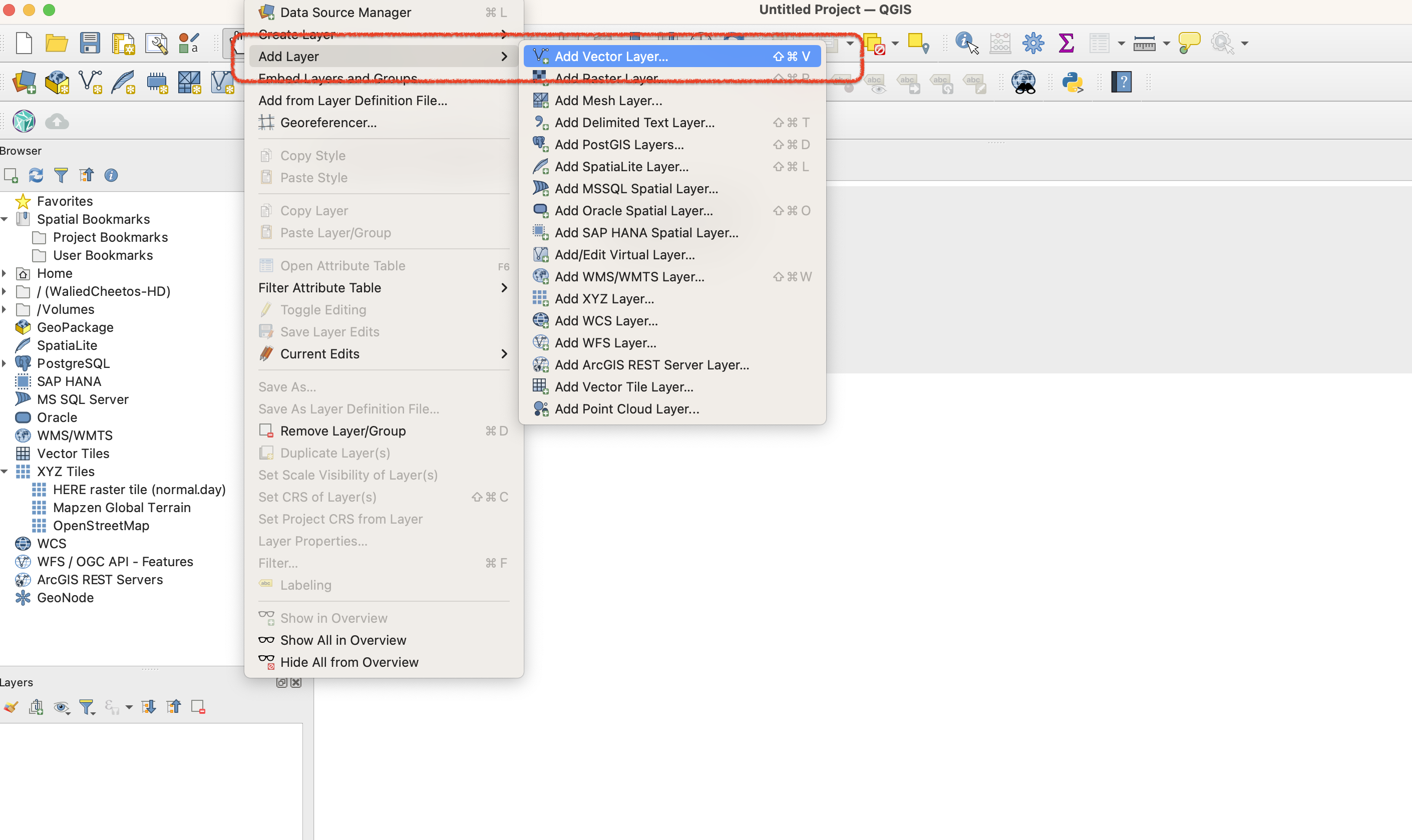
1 Add Layer >> Add Vector Layer
===============================
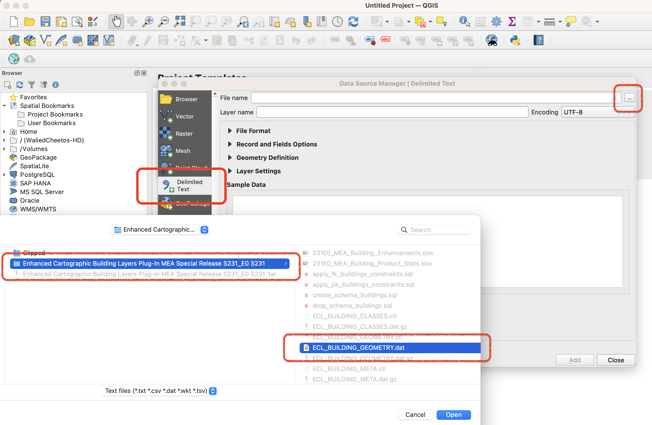
2 Select “Delimited Text” and browse for HERE ECL Building Footprints *.DAT file dataset “ECL_BUILDING_GEOMETRY.dat”
=============================================================================================================================
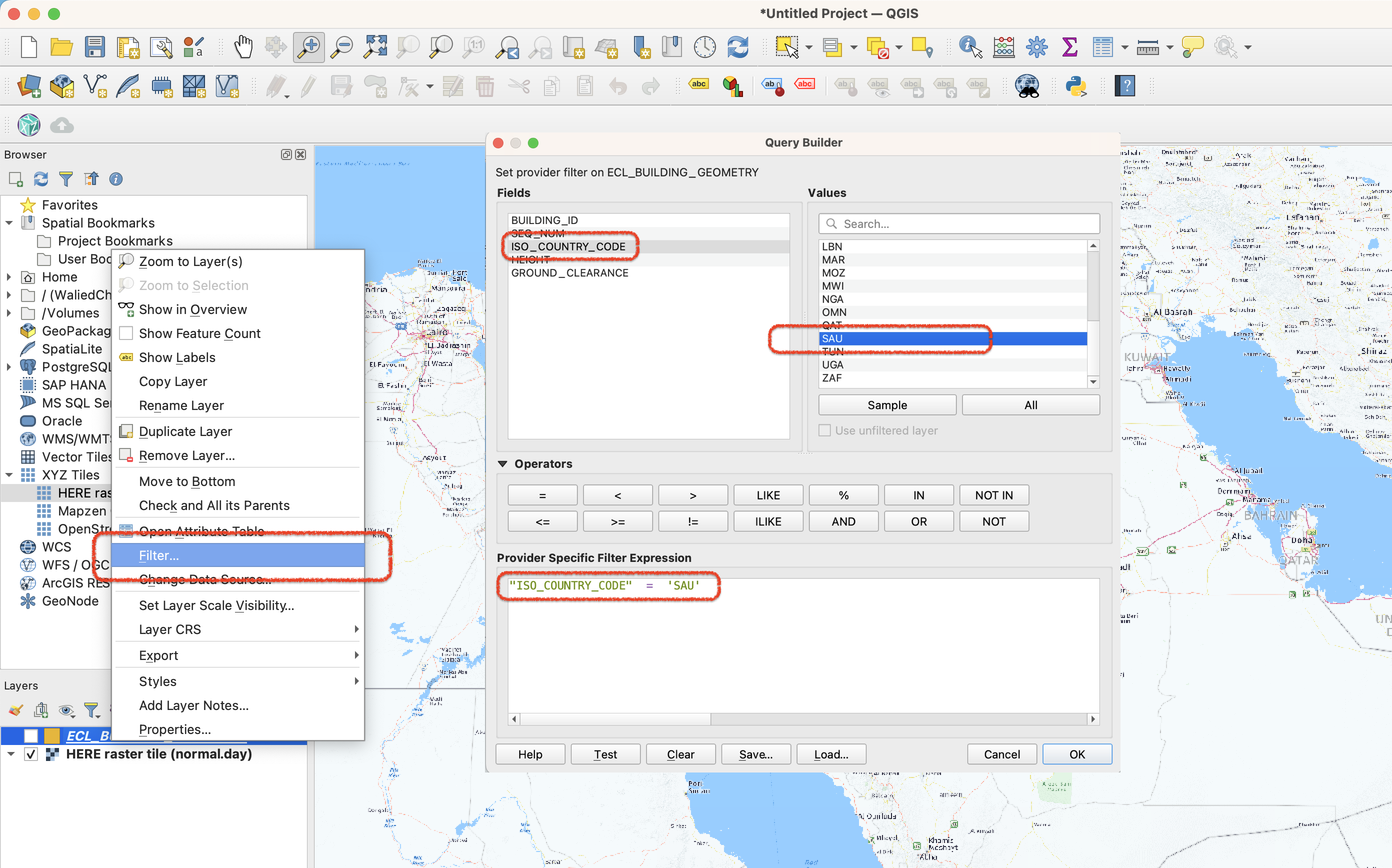
3 [OPTIONAL] Filter the dataset on country ISO code
===================================================
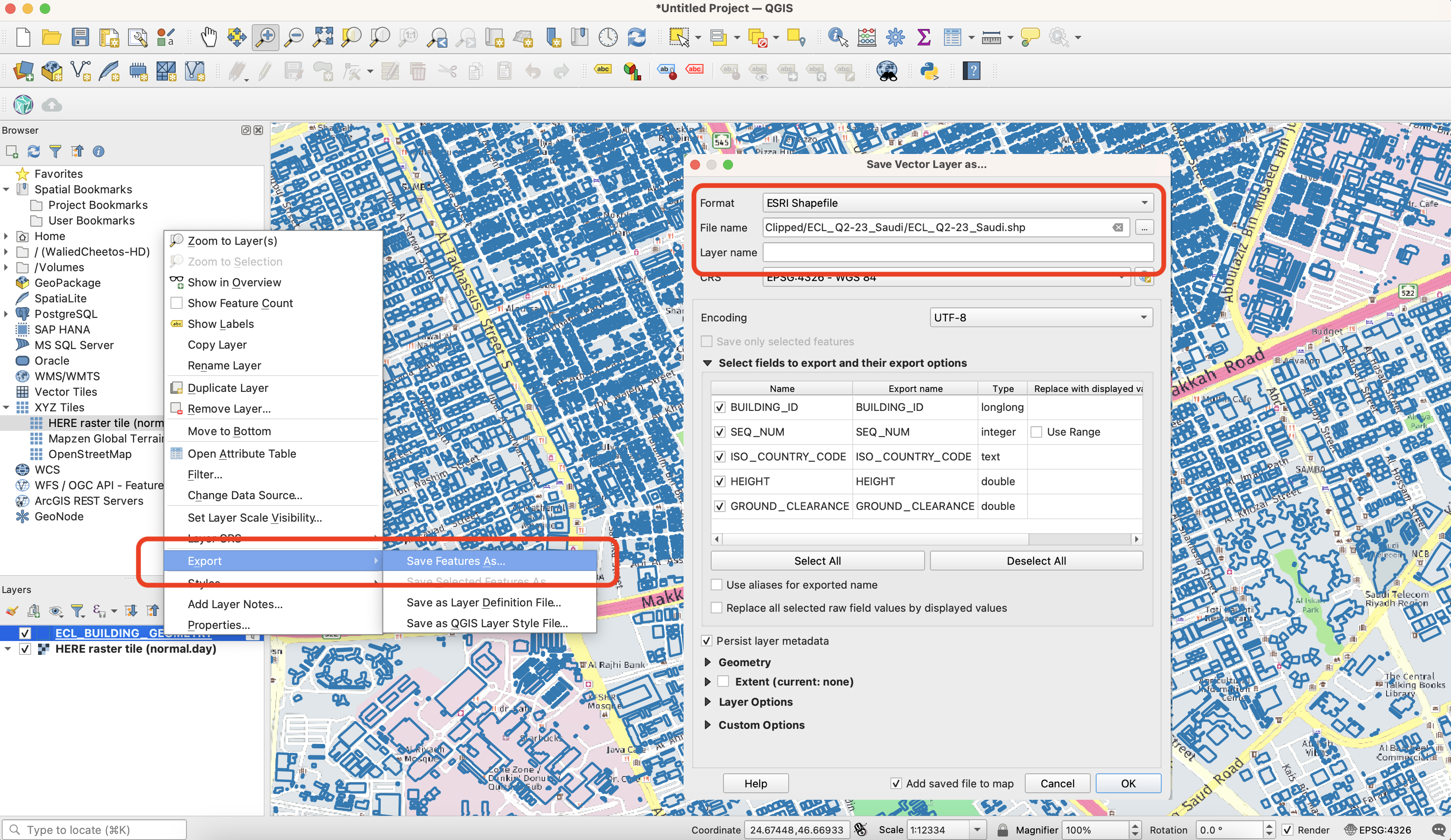
4 [OPTIONAL] Export the filtered dataset to Shapefile
=====================================================