

Chile Map Approval: How to Represent the Campo de Hielo Sur Disputed Area for DIFROL Compliance
Chile Map Approval – Campo de Hielo Sur Disputed Area Not Displayed or Displayed Using a Different Feature Type
Symptoms
Customers may report one or more of the following:
Uncertainty about how the Campo de Hielo Sur disputed area must be represented on maps displayed in Chile.
Assumption that the disputed area must be drawn only using an Intermittent River feature.
Questions regarding DIFROL compliance when a line, polygon, or other geometry is used instead of an Intermittent River feature.
Concerns that map approval may fail because the disputed area is displayed using a different cartographic representation.
Confusion caused by examples shown in HERE documentation or white papers.
Answer
For DIFROL compliance, the Campo de Hielo Sur disputed area must be visible on the map. DIFROL does not require the disputed area to be represented using a specific feature type. Any cartographic representation that clearly displays the disputed area is acceptable, including line features, polygons, or a sequence of points. The Intermittent River feature shown in HERE examples is only one possible implementation and is not a mandatory requirement.
Expected Behavior
The disputed Campo de Hielo Sur area is clearly visible on the map and identifiable as a disputed region, regardless of the underlying feature type used to represent it. Acceptable implementations may include:
Dashed line features
Polygon geometries
Multiple connected points
* Other visual representations that clearly indicate the disputed area
An example implementation using a dashed line is shown below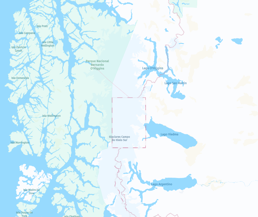
Updated 3 days ago