How does HERE calculate the midpoint/centerpoint of a postal area, if you enter a postcodes WEGO.com
How does HERE calculate the midpoint/centerpoint of a postal area, if you enter a postcodes WEGO.com?
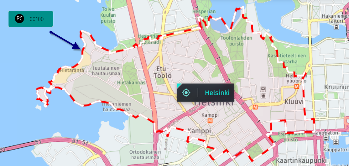
The centroids/midpoints are indeed being calculated based on the polygon, being in the middle of them.
Might be moved a little in case the middle of the polygon is e.g. a waterbody, the midpoint will moved next to it then.
Example: postal code 00100, Finland